

10 Panel Drug Test, Gardendale, AL
Accredited Drug Testing provides a 10-panel drug test at testing centers located in Gardendale AL and throughout the local area. Same day service is available, and most testing centers are within minutes of your home or office. DOT drug testing and ETG Alcohol testing is also available.
919 Odum Rd 1.1 miles
GARDENDALE, AL 35071
2244 NORTH RD 1.3 miles
GARDENDALE, AL 35071
2038 SPRINGDALE LN 5.6 miles
BIRMINGHAM, AL 35217
3001 27TH ST N 7.5 miles
BIRMINGHAM, AL 35207
4360 MAIN ST 7.8 miles
PINSON, AL 35126
1664 FORESTDALE BLVD 8.0 miles
BIRMINGHAM, AL 35214
9232 PARKWAY E 8.2 miles
BIRMINGHAM, AL 35206
721 GADSDEN HWY 9.4 miles
BIRMINGHAM, AL 35235
5892 TRUSSVILLE CROSSING PKWY 9.8 miles
BIRMINGHAM, AL 35235
48 MEDICAL PARK DR STE 250 9.8 miles
BIRMINGHAM, AL 35235
3221 3RD AVE S 9.9 miles
BIRMINGHAM, AL 35222
2124 4TH AVE S 10.4 miles
BIRMINGHAM, AL 35233
2700 10TH AVE S BLDG 2 STE 103 10.6 miles
BIRMINGHAM, AL 35205
800 MONTCLAIR RD 10.6 miles
BIRMINGHAM, AL 35213
1500 4TH AVE S 10.7 miles
BIRMINGHAM, AL 35233
616 9TH ST S 11.1 miles
BIRMINGHAM, AL 35233
5890 VALLEY RD STE 200 11.2 miles
BIRMINGHAM, AL 35235
920 S 18th St Ste B 11.2 miles
BIRMINGHAM, AL 35205
701 PRINCETON AVE SW 11.2 miles
BIRMINGHAM, AL 35211
833 PRINCETON AVE SW 11.3 miles
BIRMINGHAM, AL 35211
1201 11TH AVE S STE 100 11.4 miles
BIRMINGHAM, AL 35205
1919 28TH AVE S STE 123 12.5 miles
HOMEWOOD, AL 35209
7 OFFICE PARK CIR 12.8 miles
MOUNTAIN BROOK, AL 35223
2757 GREEN SPRINGS HWY 13.1 miles
BIRMINGHAM, AL 35209
513 Brookwood Blvd, Suite 506, Brookwood Medical Plaza 13.7 miles
Birmingham, AL 35209
2018 BROOKWOOD Medical Center Dr STE G2 13.8 miles
BIRMINGHAM, AL 35209
200 MONTGOMERY HWY STE 100 14.3 miles
VESTAVIA, AL 35216
6554 AARON ARONOV DR 14.4 miles
FAIRFIELD, AL 35064
1 W LAKESHORE DR STE 301 14.5 miles
BIRMINGHAM, AL 35209
232 PARKWAY DR SW 15.1 miles
LEEDS, AL 35094
110 Oxmoor Ct 15.2 miles
Birmingham, AL 35209
5410 HIGHWAY 280 STE 100 15.7 miles
BIRMINGHAM, AL 35242
1360 MONTGOMERY HWY STE 114 16.2 miles
VESTAVIA, AL 35216
5569 GROVE BLVD STE 121 18.1 miles
HOOVER, AL 35226
101 MISSIONARY RDG STE 100 18.1 miles
BIRMINGHAM, AL 35242
3321 LORNA RD STE 6 18.4 miles
BIRMINGHAM, AL 35216
1680 MONTGOMERY HWY 18.4 miles
HOOVER, AL 35216
1678 MONTGOMERY HWY STE 104 18.6 miles
BIRMINGHAM, AL 35216
2701 MOODY PKWY 18.6 miles
MOODY, AL 35004
2146 CENTENNIAL DR 19.3 miles
HOOVER, AL 35216
3151 CREWS LANE 20.3 miles
LINCOLN, AL 35096
2500 SOUTHLAKE PARK 20.8 miles
HOOVER, AL 35244
153 NARROWS PKWY STE 202 21.8 miles
BIRMINGHAM, AL 35242
151 NARROWS PKWY STE 110 22.1 miles
BIRMINGHAM, AL 35242
995 9TH AVE SW 22.3 miles
BESSEMER, AL 35022
709 MEMORIAL DR 22.3 miles
BESSEMER, AL 35022
919 MEDICAL CENTER DR 22.4 miles
BESSEMER, AL 35022
4917 PROMENADE PKWY STE 107 24.8 miles
BESSEMER, AL 35022
Urine drug testing is the most common and customizable screening method available in the drug testing world. Many times, drug tests are ordered from companies, courts, or individuals without knowing what drug panel is needing to be analyzed.
The most common drug panel options include the 5,10, 12, 14 and 17 panel drug tests but we also offer specialized and customized panels based on your specific need and we are here to discuss exactly what is tested in each type of drug test panel.
Urine or Hair Drug Testing in Gardendale, AL - You Choose!
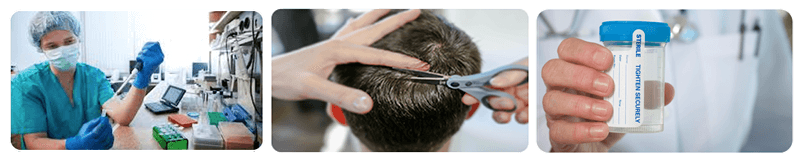
The detection period for a urine drug test is 1-5 days. However, hair drug testing is becoming more common because the detection period for a standard hair test can be up to 90 days. You must have at least an inch and a half of hair (1.5 inches) on your head or body hair may be used when conducting a hair drug test.
Facts About 10 Panel Drug Test
- The most cost-effective option in the workplace
- Most common and customizable screening method
- Detects recent drug use
- Available in instant or lab based testing options
Remember that many opioid addictions lead to further drug use, including heroin, so you may find that a standard 5 and 10 panel is not fulfilling your needs. In this case, consider a 12-panel drug test, which tests for additional opiates and painkillers that would not show up on a test with fewer panels.
A urine drug test detects recent drug use and is currently the only testing method that is approved for federally mandated drug testing.(5 panel DOT drug Test) Urine testing is appropriate for all testing reasons, from pre-employment to random to post-accident - and can be performed for a wide range of illicit and prescription drugs.
What drug are tested for in a 10 Panel Drug Test?
The drugs tested in a10 panel urine drug test include:
- Amphetamines
- Barbiturates
- Benzodiazepines
- Cocaine
- Marijuana
- MDA
- Methadone
- Methaqualone
- Opiates
- PCP
- Propoxyphene
The standard 10 panel drug test is typically collected at a collection site and analyzed at a SAMHSA Certified Laboratory. If you need a rapid results test, the 10 panel is available for a rapid result in most areas Nationwide. Results for a rapid results test are typically available the same business day (for negative results) and if a non-negative result exist, we send the specimen to the lab to perform confirmation testing at no additional charge.
What is a drug test?
A drug test is a technical analysis of a biological specimen such as urine, hair, blood, breath, finger nail and oral fluid/saliva. The common procedure for a drug test is to have a donor provide a specimen to a drug testing collection specialist, complete a chain of custody form and then the collector will send by carrier the specimen to a laboratory for analysis and a determination if the specimen is negative or positive. Although there many laboratories in the United States which provide drug testing analysis, it is recommended that only a laboratory that is SAMHSA Certified is to be used when determining a drug testing result.
Does passive smoke inhalation cause a false positive for marijuana?
"Passive" smoke inhalation from being in a room with people smoking marijuana is not considered valid, as the cut-off concentrations for lab analysis are set well above that which might occur for passive inhalation.
Other abnormalities in the urine screen may indicate that results may be a false negative or that there was deliberate adulteration of the sample. For example:
- a low creatinine lab value can indicate that a urine sample was tampered with; either the subject diluted their urine by consuming excessive water just prior to testing, or water was added to the urine sample.
- creatinine levels are often used in conjunction with specific gravity to determine if samples have been diluted. To help avoid this problem, the testing lab may color the water in their toilet blue to prevent the sample being diluted with water from the toilet.
- subjects may also attempt to add certain enzymes to the urine sample to affect stability, but this often changes the pH, which is also tested.
How long do drugs stay in your system?
The window of detection or often times referred to as look back period of a drug test depend on several factors. Some of the factors impacting how long a drug will stay in your system are:
- The amount of the drug taken
- The frequency of the drug taken
- The type of drug taken
- An individual's body metabolic rate and general health
- The amount of fluids consumed since ingesting the drug
- The amount of exercise since ingesting the drug
- Other genetic variations that would impact an individual's response to a specific drug
In the case of life-threatening symptoms, unconsciousness, or bizarre behavior in an emergency situation, screening for common drugs and toxins may help find the cause, called a toxicology test or tox screen to denote the broader area of possible substances beyond just self-administered drugs. These tests can also be done post-mortem during an autopsy in cases where a death was not expected. The test is usually done within 96 h (4 days) after the desire for the test is realized. Both a urine sample and a blood sample may be tested.
ADT offers 10 panel urine drug tests in Gardendale, AL.
Don't see your location, call us today at
(800) 221-4291
(800) 221-4291
Gardendale Drug Testing locations
To schedule a 5, 10, 12, 14 or 17 panel urine or hair drug test at a testing center in Gardendale AL, please call (800) 221-4291 or schedule online.
Were you looking, instead, for:
Local Gardendale Information
Local Area Info: Gardendale, Alabama
A large farm settlement near the area today known as Gardendale was settled around 1825. Some years later, other settlers began to move into the community commonly known as Jugtown, a name given to the area based on the presence of a large jug and churn factory that operated in the area. Some years later, Hettie Thomason Cargo, a school teacher, would lead a campaign to change the name of the community. In 1906, the name Gardendale was selected, and in 1955, the City of Gardendale was officially incorporated. Today, with more than 13,000 residents (estimated), the city of Gardendale has grown to include more than 400 businesses, 4 schools, and 24 churches.
In 1996, the Olympic torch run passed through the city during the weeks leading up to the 1996 Summer Olympic Games in Atlanta. Before Interstate 65 was constructed, the main route between Nashville, Tennessee and Birmingham, Alabama was U.S. Route 31. Prior to being built as a four-lane road, U.S. 31 was a twisting two-lane road that is still largely visible today. From the north end of Gardendale, it is now Snow Rogers Road, North Road, Moncrief Road, and then Main Street southward through the city to the Fultondale city limit where it becomes Stouts Road. In the fall of 2008, new signs were placed along the original route of Stouts Road through Gardendale denoting its historical significance as a stagecoach route between Tennessee and Birmingham during the 19th century. The first traffic signals in the city were located along U.S. 31 at Tarrant Road, Fieldstown Road, and Moncrief Road as well as Tarrant Road at Pineywood Road. A new signal at the intersection of Fieldstown Road and Main Street near city hall replaced a blinking signal shortly thereafter. Fieldstown Road was a narrow two lane road from U.S. 31 westward until Interstate 65 was built and then Fieldstown Road was re-routed onto the new road in the mid-1980s. An abundance of traffic signals have been erected in the city since those early days. In approximately 1970, the city installed street lights along U.S. 31 from the Fultondale city limits northward to the Moncrief Road intersection. The technology at that time was for blue vapor lights. Today, nearly 40 years later those same blue vapor lights still exist with some being replaced with the more modern bulbs near major intersections. Since 1980, Gardendale has annexed considerable amounts of land on the north, east, and west sides. Much of the eastern area is uninhabited. The western annexation is centered along Fieldstown Road. Most of the newest residential development has been in this area and along Shady Grove Road south of Fieldstown Road. The northern annexation has centered along US 31 and extends nearly 2 miles (3.2 km) farther north than 1980. The city has a working historical society, established January 23, 2006, that is working to record the history of the Gardendale area. They have a museum that is open to the public on Saturday mornings each week. It contains a variety of photographs, documents, and other historical memorabilia from Gardendale.[citation needed]
Gardendale is located at 33°39?36?N 86°48?46?W? / ?33.66000°N 86.81278°W? / 33.66000; -86.81278 (33.6601033, -86.8127702). According to the U.S. Census Bureau, the city has a total area of 18.0 square miles (47 km2), all land. However, with the recent annexation of several thousand acres from the community of Mt. Olive and other unincorporated areas, the city now has an estimated total area of around 25.0 square miles (65 km2). Gardendale is situated along one of the three major transportation corridors from the Midwest to the Gulf Coast (I-75, I-65, I-55). A tremendous volume of freight (via rail and truck) passes through or near Gardendale.