

On-Site Drug Testing Treynor, IA
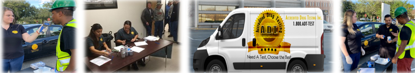
Time is money, we can come to you. Accredited Drug Testing provides on-site drug testing services in Treynor, IA and throughout the local area for employers who need drug or alcohol testing at their place of business or other location. On-site drug testing methods include urine drug testing, hair drug testing, oral saliva drug testing and breath alcohol testing. Both instant drug test results and laboratory analyzed testing is available. Testing purposes can include pre-employment, random, reasonable suspicion and post-accident.
3502 METRO DR STE 202 11.6 miles
COUNCIL BLUFFS, IA 51501
933 E PIERCE ST 11.8 miles
COUNCIL BLUFFS, IA 51503
715 Harmony St Ste 201 12.1 miles
COUNCIL BLUFFS, IA 51503
14 N WALNUT ST 13.9 miles
GLENWOOD, IA 51534
1307 HARLAN DR 16.7 miles
BELLEVUE, NE 68005
1830 VAN CAMP AVE 17.0 miles
OMAHA, NE 68108
4832 S 24th Street 17.4 miles
Omaha, NE 68107
2900 F ST 17.8 miles
OMAHA, NE 68107
601 N 30TH ST 18.0 miles
OMAHA, NE 68131
2803 JACK PINE ST 19.0 miles
BELLEVUE, NE 68123
11535 S 31ST ST 19.2 miles
BELLEVUE, NE 68123
3308 SAMSON WAY STE 102 19.4 miles
BELLEVUE, NE 68123
4620 S 50TH ST 19.7 miles
OMAHA, NE 68117
5362 S 72ND ST 21.5 miles
RALSTON, NE 68127
7710 MERCY RD STE 124 21.8 miles
OMAHA, NE 68124
8419 S 73RD PLZ 21.8 miles
PAPILLION, NE 68046
140 S 77TH ST 21.9 miles
OMAHA, NE 68114
8011 CHICAGO ST 22.2 miles
OMAHA, NE 68114
8303 DODGE ST 22.3 miles
OMAHA, NE 68114
8610 W DODGE RD 22.6 miles
OMAHA, NE 68114
8814 MAPLE ST 22.9 miles
OMAHA, NE 68134
9449 J ST 23.3 miles
OMAHA, NE 68127
9602 M ST 23.4 miles
OMAHA, NE 68127
9717 Q ST 23.6 miles
OMAHA, NE 68127
5426 S 99TH ST 23.7 miles
OMAHA, NE 68127
10020 Nicholas Street Suite 10, 23.8 miles
Omaha, NE 68114
2821 S 108TH ST 24.3 miles
OMAHA, NE 68144
6751 N 72ND ST STE 205 IMMANUEL TWO PROFESSIONAL CTR 24.6 miles
OMAHA, NE 68122
11330 R ST 24.8 miles
OMAHA, NE 68137
Drug Test Screening Panels Available In Treynor, IA
We offer a 5-panel drug test, which screens for the following:
- Amphetamines
- Cocaine
- Marijuana
- Opiates
- PCP
We offer a 10-panel drug test which screens for the following:
- Amphetamines
- Barbituates
- Benzodiazepines
- cocaine
- Marijuana
- MDA
- Methadone
- Methaqualone
- Opiates
- PCP
- Propoxyphene
We offer a 12-panel drug test which screens for the following:
- Amphetamines
- Barbiturates
- Benzodiazepines
- cocaine
- Marijuana
- MDA
- Methadone
- Methaqualone
- Opiates
- PCP
- Propoxyphene
- Meperidine
- Tramadol
** Customized drug testing panels such as bath salts, synthetic marijuana, steroids and other drugs are also available.
Urine or Hair On-site Drug Testing In Treynor, IA - You Choose!
Our on-site drug testing services in Treynor, IA include urine drug testing, which has a detection period of 1-5 days and hair drug testing which has a detection period of up to 90 days. Negative test results are generally available in 24-48 hours, when analyzed by our SAMHSA Certified Laboratories. Negative instant test results are available immediately, non-negative test results require laboratory confirmation.
Why Use On-Site Drug Testing in Treynor, IA?
Time is money and when sending an employee to one of our many drug testing centers in Treynor, IA would cause disruption to your business operations or affect your employees work productivity, conducting on-site drug testing will eliminate these issues.
Who Uses On-Site Drug Testing?
- Construction Sites
- Manufacturing Plants
- Power Plants
- Motor Pool Facilities
- Car Dealerships
- Trucking/Transportation Companies
- Schools
- Sports Venues
- Hospitals
- Oil & Gas Drillings Sites
Are you a DOT Regulated Company?
Accredited Drug Testing has trained and qualified collectors who also specialize in providing on-site drug testing services for all DOT modes to include:
- Trucking Industry-FMCSA
- Maritime Industry-USCG
- Aviation Industry-FAA
- Public Transportation-FTA
- Railroad Industry-FRA
- Pipeline Industry-PHMSA
Additional DOT Services:
- DOT Consortium Enrollment
- DOT Physicals
- Supervisor Training
- DOT Drug Policy Development
- MVR Reports
- Employee Training
- Background Checks
- FMCSA Clearinghouse Verification/Search
How To Schedule On-Site Drug Testing In Treynor, IA?
Step 1 - Call our on-site coordinator at (800)221-4291
Step 2 - Have at least 10 employees needing to be tested (recommended)
Step 3 - Provide the date, location and time of the requested on-site drug testing services
In addition to on-site drug testing in Treynor, IA, we also have drug testing centers available at the following locations.
Were you looking, instead, for:
Local Area Info: Treynor, Iowa
Treynor began east of Council Bluffs in the late 1880s with the establishment of Fritz Eyberg's General Store, August Olderog's dance hall and saloon, and St Paul's German Evangelical Church. The vicinity east of Middle Silver Creek had previously been known for its number of wolves. Local German immigrant farmers referred to the settlement as Four Corners or High Five, a popular card name, until the post office opened in the early 1890s as Treynor, named after the recently deceased Council Bluffs postmaster. By the time the town was incorporated in 1905 it included two general stores, two saloons, a furniture/implement house, a livery stable, several blacksmith shops, and the Treynor State Bank. In 1911 the community got its own railroad with the opening of the Iowa & Omaha Shortline which ran 12 miles to Mineola on the Wabash Railroad line southeast of Council Bluffs. The line was unprofitable and ended operations after five years. The Great Depression closed down the Treynor State Bank while improvements began on the "Short-line" Road from Treynor to Council Bluffs that is now Iowa Highway 92. An Air Force radar base operated just outside town during the early years of the Cold War.
As of the census of 2010, there were 919 people, 363 households, and 269 families residing in the city. The population density was 1,584.5 inhabitants per square mile (611.8/km2). There were 381 housing units at an average density of 656.9 per square mile (253.6/km2). The racial makeup of the city was 99.9% White and 0.1% African American. Hispanic or Latino of any race were 0.1% of the population.
There were 363 households of which 35.8% had children under the age of 18 living with them, 64.2% were married couples living together, 7.7% had a female householder with no husband present, 2.2% had a male householder with no wife present, and 25.9% were non-families. 23.4% of all households were made up of individuals and 10.8% had someone living alone who was 65 years of age or older. The average household size was 2.53 and the average family size was 3.01.