
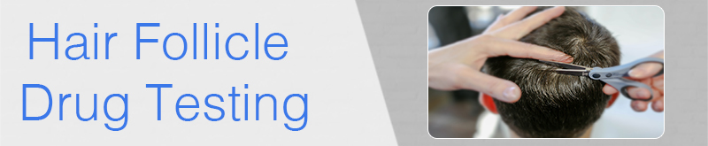
Hair Follicle Drug Testing Brownsville, PA
Accredited Drug Testing Inc provides Hair Follicle drug testing Brownsville, PA for individuals and employers needing a drug test utilizing the hair follicle analysis process. To schedule a hair follicle drug test in Brownsville, PA, Call (800) 221-4291. Most testing centers are within minutes of your home or office.
Hair follicle drug testing Brownsville, PA is available for 5, 10, and 12 panel drug screenings.
To schedule a Hair Follicle Drug Test at one of our testing centers in the Grady county area, Call (800) 221-4291, Same Day Service Available. Testing centers do not require an appointment, but you must call and register for the test.
Hair follicle drug testing is becoming a more popular method by employers and individuals in need of a drug test due to the detection time frame being longer than a standard urine test.
Local Hair follicle drug testing Brownsville, PA centers are available to assist our clients throughout the entire process and all of our hair follicle drug testing Brownsville, PA facilities have certified drug testing technicians available to conduct a hair follicle drug test collection.
Hair Follicle Drug Test
In recent years the method to conduct drug testing has more frequently included a hair follicle drug test. Many employers, courts and Substance Abuse Professionals are requiring a hair follicle drug test instead of a standard urine test. Hair follicle drug tests are used by employers who have zero-tolerance drug use policies, courts and individuals on probation. The primary benefit of a hair follicle drug test includes a much longer detection period for drug use which typically is up to 90 days. However, when screening drug use within the last 5 days the urine test continues to be the most accurate test.
Hair Follicle Drug Test Process
The procedure used to perform a hair follicle test is simple, the drug testing specialist will cut approximately 120 strands of hair (not really a lot) utilize a chain of custody procedure and send the hair to a certified laboratory for analysis. Drug testing centers require at least 1.5 inches of hair to perform this test and the hair generally needs to come from the head, however if the donor does not have head hair certain testing centers can use hair from chest, leg or arm pit.
If a donor has no hair on their body, than a hair test cannot be performed!
Hair Follicle Drug Test Results
Once the hair follicles have been analyzed by a certified laboratory they will then be reviewed and then verified by a Medical Review Officer (licensed Physician) who will than release the results. Generally a negative hair follicle drug test result is available in 2-3 days. A non-negative hair follicle drug test is available in approximately 5 days.
Urine cut-off levels are expressed in nanograms per milliliter (ng/mL) or as a weight of drug per unit volume of urine. Hair cut-off levels are expressed in picograms per milligram (pg/mg) or as a weight of drug per unit weight of hair
5 Panel Hair Follicle Drug Test
The 5 panel hair follicle drug test screens for the following
- Amphetamine
- Cocaine
- Marijuana
- Opiates
- Phencyclidine
5 Panel w/ Expanded Opiates Hair Follicle Drug Test
The 5 panel w/ expanded Opiates hair drug test screens for the standard 5 drugs but will also screen for Opiate class drugs such as pain killers, which may indicate abuse of prescription drugs
- Amphetamine
- Cocaine
- Codeine
- Marijuana
- Morphine
- Phencyclidine
- Hydrocodone
- Hydromorphone
- Oxycodone
- Oxymorphone
- 6 AM- Heroine
10 Panel Hair Follicle Drug Test
The 10 panel hair follicle drug test screens for the following
- Amphetamines
- Barbiturates
- Benzodiazepines
- Cocaine
- Marijuana
- Methadone
- Methamphetamine
- Opiates
- Phencyclidine
- Propoxyphene
12 Panel Hair Follicle Drug Test
The 12 panel hair follicle drug test screens for the following
- Amphetamines
- Barbiturates
- Benzodiazepines
- Cocaine
- Marijuana
- Meperidine
- Methadone
- Opiates
- Oxycodone
- Phencyclidine
- Propoxyphene
- Tramadol
To schedule a Hair follicle Drug Testing Brownsville, PA Call (800)221-4291.
Accredited Drug Testing Inc. is pleased to provide hair follicle drug testing, alcohol testing, occupational health and DNA testing services in Brownsville, PA.
129 SIMPSON RD, STE 105 1.4 miles
BROWNSVILLE, PA 15417
125 SIMPSON RD 2.1 miles
BROWNSVILLE, PA 15417
220 GREENE PLZ STE 103 6.9 miles
WAYNESBURG, PA 15370
220 GREENE PLZ 6.9 miles
WAYNESBURG, PA 15370
625 LINCOLN AVE STE 203 8.0 miles
NORTH CHARLEROI, PA 15022
760 Tri County Lane, Suite 104, 8.2 miles
Belle Vernon, PA 15012
860 ROSTRAVER RD 8.3 miles
BELLE VERNON, PA 15012
1200 MCKEAN AVE STE 107 8.5 miles
CHARLEROI, PA 15022
1895 JEFFERSON RD 9.8 miles
RICES LANDING, PA 15357
325 MCCLELLANDTOWN RD 10.6 miles
UNIONTOWN, PA 15401
659 CHERRY TREE LN 10.9 miles
UNIONTOWN, PA 15401
675A CHERRY TREE LN 11.1 miles
UNIONTOWN, PA 15401
1000 MCKEAN AVE 11.1 miles
DONORA, PA 15033
1163 COUNTRY CLUB RD 11.2 miles
MONONGAHELA, PA 15063
404 West Main Street, 11.3 miles
Uniontown, PA 15401
211 EASY ST STE 224 11.3 miles
UNIONTOWN, PA 15401
500 W BERKELEY ST 11.4 miles
UNIONTOWN, PA 15401
100 WOODLAWN AVE STE 300 11.6 miles
UNIONTOWN, PA 15401
800 PLAZA DR STE 210 11.8 miles
BELLE VERNON, PA 15012
4918 STATE ROUTE 51 S 12.4 miles
BELLE VERNON, PA 15012
447 W Main Street, 12.7 miles
Monongahela, PA 15063
146 MOTOR DROME RD 13.1 miles
SMITHTON, PA 15479
1829 UNIVERSITY RD 13.1 miles
DUNBAR, PA 15431
1829 UNIVERSITY DR 13.1 miles
DUNBAR, PA 15431
140 N BEESON AVE STE 300A 13.5 miles
UNIONTOWN, PA 15401
1144 NATIONAL PIKE, 13.8 miles
HOPWOOD, PA 15445
1440 Morrell Ave 14.9 miles
Connellsville, PA 15425
135 LOVES HILL EXT 14.9 miles
WAYNESBURG, PA 15370
1048 MORRELL AVE 15.0 miles
CONNELLSVILLE, PA 15425
7 GLASSWORKS RD 15.5 miles
GREENSBORO, PA 15338
301 S ARCH ST 15.5 miles
CONNELLSVILLE, PA 15425
350 BONAR AVE 17.6 miles
WAYNESBURG, PA 15370
2629 MOUNT MORRIS RD 17.6 miles
WAYNESBURG, PA 15370
35 N PORTER ST 17.9 miles
WAYNESBURG, PA 15370
501 W HIGH ST 18.6 miles
WAYNESBURG, PA 15370
308 BESSEMER RD STE 100 19.0 miles
MT PLEASANT, PA 15666
565 COAL VALLEY RD SOUTH HILLS MEDICAL BUILDING SUITE 502 19.1 miles
CLAIRTON, PA 15025
811 S Center Ave 19.3 miles
NEW STANTON, PA 15674
6396 STATE ROUTE 819 S 19.6 miles
MT PLEASANT, PA 15666
508 S CHURCH ST 19.7 miles
MOUNT PLEASANT, PA 15666
615 W SMITHFIELD ST 20.0 miles
MOUNT PLEASANT, PA 15666
1200 Brooks Ln STE 100 20.4 miles
CLAIRTON, PA 15025
575 Coal Valley Road Suite 502 20.6 miles
Pittsburgh, PA 15236
695 CLAIRTON BLVD 20.8 miles
PLEASANT HILLS, PA 15236
460 WASHINGTON RD STE 7 20.9 miles
WASHINGTON, PA 15301
161 WATERDAM RD APT 160 21.0 miles
MCMURRAY, PA 15317
1015 Waterdam Plaza Drive, 21.2 miles
Mc Murray, PA 15317
4000 WASHINGTON RD STE 203 21.3 miles
MCMURRAY, PA 15317
95 Leonard Ave STE 401, BLDG1 21.5 miles
WASHINGTON, PA 15301
3840 WASHINGTON RD STE 300 21.5 miles
MCMURRAY, PA 15317
90 West Chestnut Street, Millcraft Center 21.8 miles
Washington, PA 15301
181 W BEAU ST 21.9 miles
WASHINGTON, PA 15301
830 ROUTE 819 S 21.9 miles
MOUNT PLEASANT, PA 15666
2001 Lincoln Way, Suite 16, Oak Park Mall 22.0 miles
White Oak, PA 15131
275 CURRY HOLLOW RD, SUITE 160 22.0 miles
PITTSBURGH, PA 15236
12116 STATE ROUTE 30 22.0 miles
NORTH HUNTINGDON, PA 15642
11347 ROUTE 30 STE 3 22.0 miles
IRWIN, PA 15642
155 WILSON AVE 22.1 miles
WASHINGTON, PA 15301
100 MEDICAL BLVD 22.4 miles
CANONSBURG, PA 15317
113 CAVASINA DR STE 7 22.5 miles
CANONSBURG, PA 15317
2413 LYTLE RD 22.6 miles
BETHEL PARK, PA 15102
5219 Library Road, Unit E9, South Park Shops 22.7 miles
Bethel Park, PA 15102
1907 Lebanon Church Road, Suite 104 22.7 miles
West Mifflin, PA 15122
2600 OLD WASHINGTON RD STE 150 22.7 miles
UPPER ST CLAIR, PA 15241
140 CHURCH ST STE 102 22.8 miles
ROGERSVILLE, PA 15359
751 PITTSBURGH MCKEESPORT BLVD 22.9 miles
DRAVOSBURG, PA 15034
8943 STATE ROUTE 30, 22.9 miles
IRWIN, PA 15642
905 SPRUCE ST 23.0 miles
IRWIN, PA 15642
9173 RTE 30, STE 5 23.0 miles
IRWIN, PA 15642
206 ARLINGTON PL 23.4 miles
GREENSBURG, PA 15601
1300 Oxford Drive, Suite 1AA 23.7 miles
Bethel Park, PA 15102
2000 OXFORD DR STE 110 24.0 miles
BETHEL PARK, PA 15102
3706 5TH AVE Ste 2 24.1 miles
NORTH VERSAILLES, PA 15137
1474 ROUTE 51 24.3 miles
JEFFERSON HILLS, PA 15025
1951 LINCOLN HWY 24.4 miles
NORTH VERSAILLES, PA 15137
1691 WASHINGTON RD 24.5 miles
MOUNT LEBANON, PA 15228
3516 SAW MILL RUN BLVD 24.5 miles
PITTSBURGH, PA 15227
4176 NATIONAL PIKE STE 4 24.6 miles
FARMINGTON, PA 15437
1535 WASHINGTON RD 24.6 miles
PITTSBURGH, PA 15228
4225 Brownsville Rd, Shoppes at Brentwood 24.8 miles
Pittsburgh, PA 15227

"When you need a test, choose the best!"
Alcohol Testing Brownsville, PA Services
(800)221-4291
For more information regarding the effects of drug abuse - Click Here
For more information on a drug free work place - Click Here
Were you looking, instead, for:
Local Area Info: Brownsville, Pennsylvania
Brownsville is a borough in Fayette County, Pennsylvania, United States, first settled in 1785 as the site of a trading post a few years after the pacification of the Iroquois enabled a post-Revolutionary war resumption of westward migration. The Trading Post soon became a tavern and Inn, and was soon receiving emigrants heading west as it was located above the cut bank overlooking first ford that could be reached to those descending from the Mountains[a] Brownsville is located 40 miles (64 km) south of Pittsburgh along the east bank of the Monongahela River.
According to the United States Census Bureau, the borough of Brownsville, located as a county border town has a total area of 1.1 square miles (2.8 km2), of which 0.97 square miles (2.5 km2) is land and 0.1 square miles (0.3 km2), or 10.47%, is water—most of which is the Fayette County half of the Monongahela River between the community and the flatter lands of opposite shore West Brownsville in Washington County. As a community, the town is the central population center for a number of outlying hamlets geographically tied to the town for the same reasons they were founded nearby—Western Pennsylvania has far more hills and steep slopes than flats or gentle sloping terrains suitable for settlement. This keeps Brownsville at the nexus of the transportation infrastructure which grew up during its history. While no longer a passenger depot, the town and cross-River West Brownsville share an important Railway bridge creating a balloon loop allowing the turning of complete coal trains. Newest is the limited access toll road PA Route 43, which connects the town to strategic points and southern Pittsburgh at Clairton. River hugging PA Route 88,[b] connects to towns up and down the Mon Valley and the historic National Road (now US Route 40) reached East Saint Louis, Illinois and connected the town to the immigrants arriving in the port of Baltimore traveling west on the Cumberland Turnpike and the National Road.
From its founding, well into the 19th century, as the first reachable population center west of the Alleghenies barrier range on the Mississippi watershed, the borough quickly grew into an industrial center, market town, transportation hub, outfitting center, and river boat-building powerhouse. It was a gateway destination for emigrants heading west to the Ohio Country when a trading post, and the new United States' Northwest Territory and their "legal successors" for travelers heading westwards on the various Emigrant Trails both to the Near West and later Far West from its founding until well into the 1850s. As outfitting center, the borough provided the markets for the small-scale industries in the surrounding counties—and also, quite a few in Maryland shipping goods over the pass by mule-train via the Cumberland Narrows toll-route.