
On-Site Drug Testing Rayland, OH
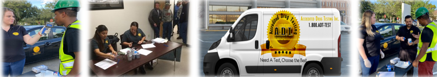
Time is money, we can come to you. Accredited Drug Testing provides on-site drug testing services in Rayland, OH and throughout the local area for employers who need drug or alcohol testing at their place of business or other location. On-site drug testing methods include urine drug testing, hair drug testing, oral saliva drug testing and breath alcohol testing. Both instant drug test results and laboratory analyzed testing is available. Testing purposes can include pre-employment, random, reasonable suspicion and post-accident.
92 N 4TH ST STE 3 6.1 miles
MARTINS FERRY, OH 43935
90 N 4TH ST 6.1 miles
MARTINS FERRY, OH 43935
24 HOMESTEAD AVE 7.1 miles
WHEELING, WV 26003
620 NATIONAL RD STE 300 7.5 miles
WHEELING, WV 26003
1 MEDICAL PARK 8.0 miles
WHEELING, WV 26003
2000 EOFF ST 8.6 miles
WHEELING, WV 26003
10 ELM GROVE CROSSING MALL 9.6 miles
WHEELING, WV 26003
1417 MAIN ST 11.7 miles
FOLLANSBEE, WV 26037
51520 NATIONAL RD E 11.7 miles
SAINT CLAIRSVILLE, OH 43950
51339 NATIONAL RD E 11.7 miles
SAINT CLAIRSVILLE, OH 43950
National Road East 12.3 miles
SAINT CLAIRSVILLE, OH 43950
539 WARD DR 12.4 miles
WINTERSVILLE, OH 43953
3203 JOHNSON RD 13.0 miles
STEUBENVILLE, OH 43952
4220 SUNSET BLVD 13.4 miles
STEUBENVILLE, OH 43952
500 LURAY DR 14.1 miles
WINTERSVILLE, OH 43953
3948 CENTRAL AVE 14.9 miles
SHADYSIDE, OH 43947
951 E Market St 16.2 miles
Cadiz, OH 43907
800 WHEELING AVE STE 1W 16.6 miles
GLEN DALE, WV 26038
601 COLLIERS WAY 16.8 miles
WEIRTON, WV 26062
218 THREE SPRINGS DR 17.0 miles
WEIRTON, WV 26062
1585 Wheeling Avenue 17.3 miles
Glendale, WV 26038
1307 LAFAYETTE AVE 18.9 miles
MOUNDSVILLE, WV 26041
350 HIGHWAY 7 N 22.5 miles
POWHATAN POINT, OH 43942
95 Leonard Ave STE 401, BLDG1 23.2 miles
WASHINGTON, PA 15301
181 W BEAU ST 23.3 miles
WASHINGTON, PA 15301
155 WILSON AVE 23.4 miles
WASHINGTON, PA 15301
90 West Chestnut Street, Millcraft Center 23.5 miles
Washington, PA 15301
Drug Test Screening Panels Available In Rayland, OH
We offer a 5-panel drug test, which screens for the following:
- Amphetamines
- Cocaine
- Marijuana
- Opiates
- PCP
We offer a 10-panel drug test which screens for the following:
- Amphetamines
- Barbituates
- Benzodiazepines
- cocaine
- Marijuana
- MDA
- Methadone
- Methaqualone
- Opiates
- PCP
- Propoxyphene
We offer a 12-panel drug test which screens for the following:
- Amphetamines
- Barbiturates
- Benzodiazepines
- cocaine
- Marijuana
- MDA
- Methadone
- Methaqualone
- Opiates
- PCP
- Propoxyphene
- Meperidine
- Tramadol
** Customized drug testing panels such as bath salts, synthetic marijuana, steroids and other drugs are also available.
Urine or Hair On-site Drug Testing In Rayland, OH - You Choose!
Our on-site drug testing services in Rayland, OH include urine drug testing, which has a detection period of 1-5 days and hair drug testing which has a detection period of up to 90 days. Negative test results are generally available in 24-48 hours, when analyzed by our SAMHSA Certified Laboratories. Negative instant test results are available immediately, non-negative test results require laboratory confirmation.
Why Use On-Site Drug Testing in Rayland, OH?
Time is money and when sending an employee to one of our many drug testing centers in Rayland, OH would cause disruption to your business operations or affect your employees work productivity, conducting on-site drug testing will eliminate these issues.
Who Uses On-Site Drug Testing?
- Construction Sites
- Manufacturing Plants
- Power Plants
- Motor Pool Facilities
- Car Dealerships
- Trucking/Transportation Companies
- Schools
- Sports Venues
- Hospitals
- Oil & Gas Drillings Sites
Are you a DOT Regulated Company?
Accredited Drug Testing has trained and qualified collectors who also specialize in providing on-site drug testing services for all DOT modes to include:
- Trucking Industry-FMCSA
- Maritime Industry-USCG
- Aviation Industry-FAA
- Public Transportation-FTA
- Railroad Industry-FRA
- Pipeline Industry-PHMSA
Additional DOT Services:
- DOT Consortium Enrollment
- DOT Physicals
- Supervisor Training
- DOT Drug Policy Development
- MVR Reports
- Employee Training
- Background Checks
- FMCSA Clearinghouse Verification/Search
How To Schedule On-Site Drug Testing In Rayland, OH?
Step 1 - Call our on-site coordinator at (800)221-4291
Step 2 - Have at least 10 employees needing to be tested (recommended)
Step 3 - Provide the date, location and time of the requested on-site drug testing services
In addition to on-site drug testing in Rayland, OH, we also have drug testing centers available at the following locations.
Were you looking, instead, for:
Local Area Info: Rayland, Ohio
Rayland is a village in Jefferson County, Ohio, United States, along the Ohio River. The population was 417 at the 2010 census. It is part of the Weirton-Steubenville, WV-OH Metropolitan Statistical Area.
According to the United States Census Bureau, the village has a total area of 0.50 square miles (1.29 km2), of which 0.47 square miles (1.22 km2) is land and 0.03 square miles (0.08 km2) is water.
As of the census of 2010, there were 417 people, 173 households, and 120 families residing in the village. The population density was 887.2 inhabitants per square mile (342.5/km2). There were 188 housing units at an average density of 400.0 per square mile (154.4/km2). The racial makeup of the village was 97.8% White, 1.0% African American, 0.2% Native American, 0.5% from other races, and 0.5% from two or more races.